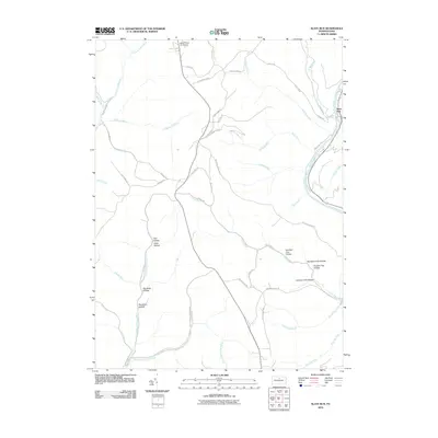
2010 Map of Slate Run
USGS Topo · Published 2010About this map
Pine Creek carves a deep valley through this northern Pennsylvania landscape, where the small settlement of Slate Run sits at the confluence of its namesake stream. The 2010 geography is defined by a dense network of forest roads and hollows, reflecting a history of timbering and remote transport. Names like Narrow Gauge Rd and Boyer Mill Rd point toward the area's industrial past, while the presence of the Black Forest Inn Airport near the northern boundary provides a rare point of modern aviation access in this isolated terrain. The landscape is heavily dissected by drainage systems such as Trout Run and Hyner Run, which are punctuated by numerous named hollows including Holt Hollow, Muschino Hollow, and the sequential Number Two Hollow through Number Four Hollow. The map also traces modern utilities via Gas Line Ter, illustrating the region's continued role in resource management.
Find a feature on this map
55 named features on this map. Tap any name to fly to it.
Don’t see what you’re looking for? This feature index may not catch every label — zoom into the map to look around manually.
Map Details
Editions of this 2010 Slate Run Map
This is the sole edition of this map. No revisions or reprints were ever made.
Other maps of this area

1937 · Waterville
USGS Topo · 1:48,000

1943 · Hyner
USGS Topo · 1:62,500

1943 · Waterville
USGS Topo · 1:62,500

1946 · Young Womans Creek
USGS Topo · 1:24,000

1946 · Antrim
USGS Topo · 1:62,500

1946 · Renovo East
USGS Topo · 1:62,500

1946 · Cedar Run
USGS Topo · 1:24,000

1946 · Slate Run
USGS Topo · 1:24,000

1946 · Renovo East
USGS Topo · 1:24,000

1946 · Glen Union
USGS Topo · 1:24,000
Featured Places
- Stewardson Township, PA
- Brown Township, PA
- Slate Run, Brown Township
- Chapman Township, PA
- Grugan Township, PA