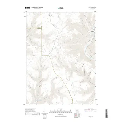
2019 Map of Slate Run
USGS Topo · Published 2019About this map
Slate Run sits at the confluence of its namesake waterway and the larger Pine Creek, marking a significant settlement point in the deep valley of the Pine Creek Gorge. This 2019 survey documents a landscape defined by sharp elevation changes and an intricate network of hollows, including Stone Quarry Hollow, Number Four Hollow, and Cannon Hole Hollow. For genealogists, the map identifies local burial sites such as the Slate Run Methodist Cem and Slate Run Baptist Cem near the town center. The transportation history of the region is evident in the transition from old woods ways like Harrowed Trl and Old Refuge Line Trl to established routes such as the Coudersport Pike. The presence of Narrow Gauge Rd hints at the area's industrial past, while numerous watercourses like Naval Run, Callahan Run, and Hyner Run illustrate the drainage patterns that carved these steep ridges at the intersection of Potter, Clinton, and Lycoming counties.
Find a feature on this map
66 named features on this map. Tap any name to fly to it.
Don’t see what you’re looking for? This feature index may not catch every label — zoom into the map to look around manually.
Map Details
Editions of this 2019 Slate Run Map
This is the sole edition of this map. No revisions or reprints were ever made.
Other maps of this area

1937 · Waterville
USGS Topo · 1:48,000

1943 · Hyner
USGS Topo · 1:62,500

1943 · Waterville
USGS Topo · 1:62,500

1946 · Young Womans Creek
USGS Topo · 1:24,000

1946 · Antrim
USGS Topo · 1:62,500

1946 · Renovo East
USGS Topo · 1:62,500

1946 · Cedar Run
USGS Topo · 1:24,000

1946 · Slate Run
USGS Topo · 1:24,000

1946 · Renovo East
USGS Topo · 1:24,000

1946 · Glen Union
USGS Topo · 1:24,000
Featured Places
- Stewardson Township, PA
- Brown Township, PA
- Slate Run, Brown Township
- Chapman Township, PA
- Grugan Township, PA