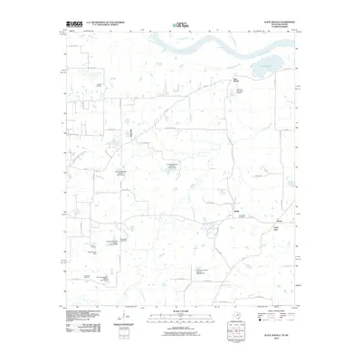
2010 Map of Slate Shoals
USGS Topo · Published 2010About this map
The Red River defines the northern boundary of this Texas-Oklahoma borderland, where the terrain is marked by a series of engineered water management sites. Numerous Soil Conservation Service dams, such as Soil Conservation Service Site 18 Dam and Stallings Lake Dam, are scattered throughout the landscape, reflecting an era of focused land reclamation and watershed control. These structures, along with the Howard Lake Dam, suggest a transition from the river's natural flood cycles to a more managed agricultural environment.
Find a feature on this map
50 named features on this map. Tap any name to fly to it.
Don’t see what you’re looking for? This feature index may not catch every label — zoom into the map to look around manually.
Map Details
Editions of this 2010 Slate Shoals Map
This is the sole edition of this map. No revisions or reprints were ever made.
Other maps of this area

1903 · Paris
USGS Topo · 1:125,000

1948 · Grant
USGS Topo · 1:62,500

1948 · Paris
USGS Topo · 1:62,500

1949 · Grant
USGS Topo · 1:62,500

1949 · Paris
USGS Topo · 1:62,500

1951 · Slate Shoals
USGS Topo · 1:24,000

1951 · Frogville
USGS Topo · 1:24,000

1951 · Shoals
USGS Topo · 1:24,000

1951 · Woodland
USGS Topo · 1:24,000

1953 · Texarkana
USGS Topo · 1:250,000