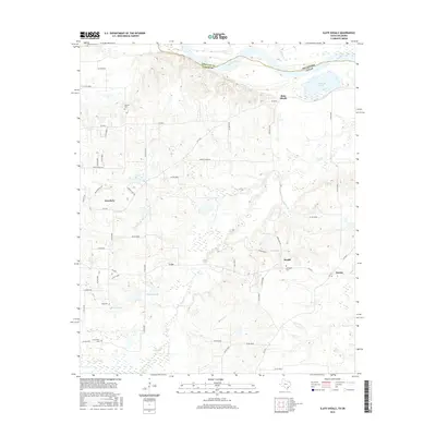
2016 Map of Slate Shoals
USGS Topo · Published 2016About this map
The Red River forms a natural border between Lamar County, Texas, and Choctaw County, Oklahoma, defining the northern edge of this landscape. Small communities and rural crossroads characterize the interior, with settlements like Powderly, Medill, and Novice linked by a network of farm-to-market roads and county routes. The terrain is marked by seasonal drainages such as Pine Creek and Ninety-mile Creek, which feed into local water bodies like Stallings Lake and Howard Lake. Genealogists will find several burial grounds across the area, including Oak Hill Cemetery and Newbethel Cemetery. The presence of the Slate Shoals landmark along the river suggests a historic crossing point or topographical feature of note in this agricultural region of northeast Texas.
Find a feature on this map
53 named features on this map. Tap any name to fly to it.
Don’t see what you’re looking for? This feature index may not catch every label — zoom into the map to look around manually.
Map Details
Editions of this 2016 Slate Shoals Map
This is the sole edition of this map. No revisions or reprints were ever made.
Other maps of this area

1903 · Paris
USGS Topo · 1:125,000

1948 · Grant
USGS Topo · 1:62,500

1948 · Paris
USGS Topo · 1:62,500

1949 · Grant
USGS Topo · 1:62,500

1949 · Paris
USGS Topo · 1:62,500

1951 · Slate Shoals
USGS Topo · 1:24,000

1951 · Frogville
USGS Topo · 1:24,000

1951 · Shoals
USGS Topo · 1:24,000

1951 · Woodland
USGS Topo · 1:24,000

1953 · Texarkana
USGS Topo · 1:250,000