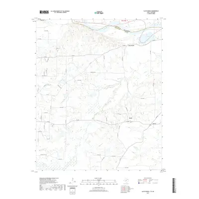
2019 Map of Slate Shoals
USGS Topo · Published 2019About this map
The Red River defines the northern boundary of this Texas-Oklahoma borderland, where Lamar and Choctaw counties meet. This 2019 survey captures a landscape structured by rural farm-to-market roads and the remnants of small agricultural communities. The settlement of Slate Shoals sits just south of the river bend, while the small hubs of Medill and Novice are situated further south along FM 195. For family historians, the map provides precise locations for several local burial grounds, including Oak Hill Cem, Long Cem, and Newbether Cem. The terrain is deeply carved by water, notably Pine Cr and Ninety-mile Cr, which flow through the wooded bottoms and pastures typical of this region's post-oak belt. Numerous secondary routes like Firehouse Rd and Springhill Rd branch out from the main thoroughfares, connecting long-established rural homesteads and properties.
Find a feature on this map
53 named features on this map. Tap any name to fly to it.
Don’t see what you’re looking for? This feature index may not catch every label — zoom into the map to look around manually.
Map Details
Editions of this 2019 Slate Shoals Map
This is the sole edition of this map. No revisions or reprints were ever made.
Other maps of this area

1903 · Paris
USGS Topo · 1:125,000

1948 · Grant
USGS Topo · 1:62,500

1948 · Paris
USGS Topo · 1:62,500

1949 · Grant
USGS Topo · 1:62,500

1949 · Paris
USGS Topo · 1:62,500

1951 · Slate Shoals
USGS Topo · 1:24,000

1951 · Frogville
USGS Topo · 1:24,000

1951 · Shoals
USGS Topo · 1:24,000

1951 · Woodland
USGS Topo · 1:24,000

1953 · Texarkana
USGS Topo · 1:250,000