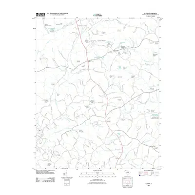
2011 Map of Slater
USGS Topo · Published 2011About this map
The North Saluda River and Mush Creek flow through this section of Greenville County, shaping a landscape defined by small settlements and numerous private impoundments. The community of Lima sits at the junction of Old Highway 25 and the river, while Cross Plains lies to the northeast. A notable density of family and community burial grounds, such as the Hawkins-Hightower Family Cemetery and Cox Chapel Cemetery, provides significant documentation for local genealogists.
Find a feature on this map
179 named features on this map. Tap any name to fly to it.
Don’t see what you’re looking for? This feature index may not catch every label — zoom into the map to look around manually.
Map Details
Editions of this 2011 Slater Map
This is the sole edition of this map. No revisions or reprints were ever made.
Other maps of this area

1888 · Pickens
USGS Topo · 1:125,000

1894 · Pickens
USGS Topo · 1:125,000

1905 · Pisgah
USGS Topo · 1:125,000

1906 · Pisgah
USGS Topo · 1:125,000

1907 · Saluda
USGS Topo · 1:125,000

1935 · Standingstone Mtn.
USGS Topo · 1:24,000

1935 · Greenville
USGS Topo · 1:48,000

1935 · Zirconia
USGS Topo · 1:24,000

1938 · Greenville
USGS Topo · 1:62,500
1946 · Standingstone Mtn.
USGS Topo · 1:24,000