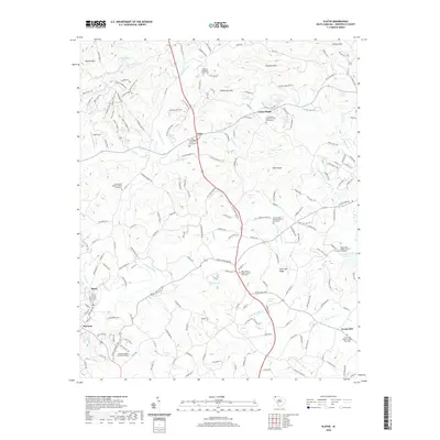
2020 Map of Slater
USGS Topo · Published 2020About this map
Lima and Cross-Plains anchor the rural landscape of northern Greenville County, where the topography transitions from the heights of Chestnut Mtn and Hightower Mtn down toward the N Saluda River and N Enoree River valleys. This modern survey reflects a deeply rooted community structure, evidenced by the high density of historic church-and-graveyard complexes that serve as local landmarks. From the Locust Hill Baptist Church Graveyard in the southeast to Cox Chapel Baptist Church Graveyard in the west, these sites provide significant genealogical value. The land is punctuated by numerous private lakes and ponds, including Poplar Lake and Chinquapin Lake, which characterize the modern drainage patterns of Beaverdam Cr and Mush Cr. The settlement at Slater remains a focal point in the southwestern corner, situated near where the river and local creeks meet the rising foothills of Watson Mtn.
Find a feature on this map
191 named features on this map. Tap any name to fly to it.
Don’t see what you’re looking for? This feature index may not catch every label — zoom into the map to look around manually.
Map Details
Editions of this 2020 Slater Map
This is the sole edition of this map. No revisions or reprints were ever made.
Other maps of this area

1888 · Pickens
USGS Topo · 1:125,000

1894 · Pickens
USGS Topo · 1:125,000

1905 · Pisgah
USGS Topo · 1:125,000

1906 · Pisgah
USGS Topo · 1:125,000

1907 · Saluda
USGS Topo · 1:125,000

1935 · Standingstone Mtn.
USGS Topo · 1:24,000

1935 · Greenville
USGS Topo · 1:48,000

1935 · Zirconia
USGS Topo · 1:24,000

1938 · Greenville
USGS Topo · 1:62,500
1946 · Standingstone Mtn.
USGS Topo · 1:24,000