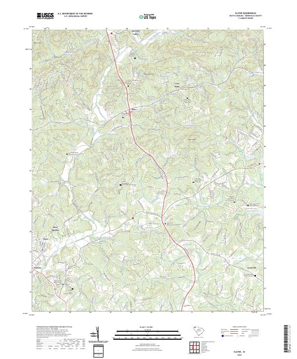
2024 Map of Slater
USGS Topo · Published 2024About this map
Slater-Marietta and the industrial village of Slater center this modern study of the Greenville County Piedmont. This landscape is defined by the headwaters of several major drainages, including the North Saluda River and the North Enoree River, which carve through the foothills near Watson Mtn and Hightower Mtn. The map preserves a dense record of community history through its many named cemeteries and graveyards, such as the Hawkins Hightower Family Cem and the Cool Springs Baptist Church Graveyard. Smaller settlements like Lima and Locust Hill serve as local anchors among a network of rural roads and residential enclaves. The concentration of religious sites, from New Liberty Baptist Church to Locust Hill Baptist Church, reflects the enduring social geography of the region as it transitions from its textile and agricultural roots into more modern developments like The Cliffs Valley.
Find a feature on this map
189 named features on this map. Tap any name to fly to it.
Don’t see what you’re looking for? This feature index may not catch every label — zoom into the map to look around manually.
Map Details
Editions of this 2024 Slater Map
This is the sole edition of this map. No revisions or reprints were ever made.
Other maps of this area

1888 · Pickens
USGS Topo · 1:125,000

1894 · Pickens
USGS Topo · 1:125,000

1905 · Pisgah
USGS Topo · 1:125,000

1906 · Pisgah
USGS Topo · 1:125,000

1907 · Saluda
USGS Topo · 1:125,000

1935 · Standingstone Mtn.
USGS Topo · 1:24,000

1935 · Greenville
USGS Topo · 1:48,000

1935 · Zirconia
USGS Topo · 1:24,000

1938 · Greenville
USGS Topo · 1:62,500
1946 · Standingstone Mtn.
USGS Topo · 1:24,000