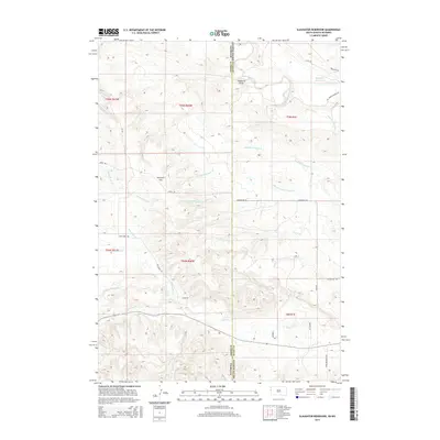
2015 Map of Slaughter Reservoir
USGS Topo · Published 2015About this map
The Belle Fourche River winds through this high-plains landscape where the borders of Wyoming and South Dakota meet. This 2015 survey documents the drainage patterns of the northern Black Hills foothills, centered on the Slaughter Reservoir and the prominent Norgrain Hill. The topography is defined by a dense network of seasonal watercourses, including Grummit Canyon Cr and the multiple forks of Hay Cr. Ranching infrastructure dominates the human geography, evidenced by local routes like Dobesh Ranch Rd and Olson Rd. The map provides a precise look at the land division and access roads in this sparsely populated cattle country, from Mona Rd in the west to Upper Redwater Rd in the southeast corner.
Find a feature on this map
31 named features on this map. Tap any name to fly to it.
Don’t see what you’re looking for? This feature index may not catch every label — zoom into the map to look around manually.
Map Details
Editions of this 2015 Slaughter Reservoir Map
This is the sole edition of this map. No revisions or reprints were ever made.
Other maps of this area

1901 · Aladdin
USGS Topo · 1:125,000

1903 · Aladdin
USGS Topo · 1:125,000

1905 · Indian
USGS Topo · 1:62,500

1907 · Belle Fourche
USGS Topo · 1:125,000

1907 · Redwater
USGS Topo · 1:62,500

1953 · Rapid City
USGS Topo · 1:250,000

1954 · The Forks
USGS Topo · 1:24,000

1954 · Gillette
USGS Topo · 1:250,000

1955 · Gillette
USGS Topo · 1:250,000

1957 · Rapid City
USGS Topo · 1:250,000