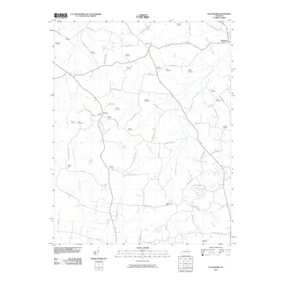
2010 Map of Slaughters
USGS Topo · Published 2010About this map
The community of Slaughters anchors the northeastern corner of this Hopkins County landscape, where the terrain shifts from the lowlands of Deer Creek to the distinct elevations of Yarbro Hill and the Shake Rag Hills. This 2010 survey reveals a high density of family and community burial grounds, such as Mount Carmel Cemetery, Utterback Cemetery, and Hobgood Cemetery, which serve as vital markers of the area's genealogical history. The settlement of Veazey sits at a crossroads in the western portion of the map, surrounded by named rural routes like Don Miller Rd and Antioch Church Rd. The drainage network, including Pond Creek and Otter Creek, dictates the winding paths of the local road system, illustrating how the natural topography continues to influence the rural infrastructure of this part of Kentucky long after its initial settlement.
Find a feature on this map
73 named features on this map. Tap any name to fly to it.
Don’t see what you’re looking for? This feature index may not catch every label — zoom into the map to look around manually.
Map Details
Editions of this 2010 Slaughters Map
This is the sole edition of this map. No revisions or reprints were ever made.
Other maps of this area

1906 · Sebree
USGS Topo · 1:62,500

1907 · Earlington
USGS Topo · 1:48,000

1908 · Calhoun
USGS Topo · 1:62,500

1909 · Earlington
USGS Topo · 1:62,500

1909 · Madisonville
USGS Topo · 1:62,500

1949 · Sebree
USGS Topo · 1:24,000

1951 · Dixon
USGS Topo · 1:24,000

1951 · Sebree
USGS Topo · 1:24,000

1952 · Beech Grove
USGS Topo · 1:24,000

1952 · Hanson
USGS Topo · 1:24,000