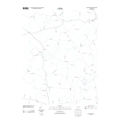
2013 Map of Slaughters
USGS Topo · Published 2013About this map
Slaughters stands as a focal point in this portion of Kentucky, where the landscape is defined by a dense network of country roads named for local families. These routes, such as Marks Poole Rd and George Oakley Rd, weave between the drainages of Deer Cr and Pond Cr. The terrain shifts from the prominent Yarbro Hill in the west toward the curiously named Shake Rag Hills to the southeast. Historically significant pathways like Old Dixon Slaughters Rd trace the movement between early settlements like Veazey. The prevalence of roads named for specific individuals, such as Tucker Schoolhouse Rd, suggests a landscape deeply rooted in family landholdings and small-scale rural infrastructure typical of the region's agricultural development.
Find a feature on this map
73 named features on this map. Tap any name to fly to it.
Don’t see what you’re looking for? This feature index may not catch every label — zoom into the map to look around manually.
Map Details
Editions of this 2013 Slaughters Map
This is the sole edition of this map. No revisions or reprints were ever made.
Other maps of this area

1906 · Sebree
USGS Topo · 1:62,500

1907 · Earlington
USGS Topo · 1:48,000

1908 · Calhoun
USGS Topo · 1:62,500

1909 · Earlington
USGS Topo · 1:62,500

1909 · Madisonville
USGS Topo · 1:62,500

1949 · Sebree
USGS Topo · 1:24,000

1951 · Dixon
USGS Topo · 1:24,000

1951 · Sebree
USGS Topo · 1:24,000

1952 · Beech Grove
USGS Topo · 1:24,000

1952 · Hanson
USGS Topo · 1:24,000