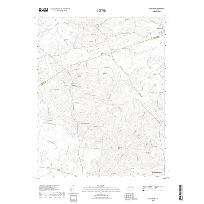
2019 Map of Slaughters
USGS Topo · Published 2019About this map
Slaughters and Manitou serve as focal points for this survey of the Hopkins and Webster county borderlands. The landscape is defined by the winding paths of Deer Cr and the E Fork Deer Cr, which carve through a terrain marked by the Yarbro Hill and the Shake Rag Hills. The mapping reveals a high density of family and community burial grounds, providing a significant resource for genealogical research. Prominent sites include Slaughters Cem, Mount Carmel Cem, and Browder Cem, often located near historical transit routes like the Stagecoach Rd. Smaller settlements such as Veazey and Hanson appear alongside an intricate network of local roads, reflecting the established rural infrastructure of this western Kentucky region.
Find a feature on this map
96 named features on this map. Tap any name to fly to it.
Don’t see what you’re looking for? This feature index may not catch every label — zoom into the map to look around manually.
Map Details
Editions of this 2019 Slaughters Map
This is the sole edition of this map. No revisions or reprints were ever made.
Other maps of this area

1906 · Sebree
USGS Topo · 1:62,500

1907 · Earlington
USGS Topo · 1:48,000

1908 · Calhoun
USGS Topo · 1:62,500

1909 · Earlington
USGS Topo · 1:62,500

1909 · Madisonville
USGS Topo · 1:62,500

1949 · Sebree
USGS Topo · 1:24,000

1951 · Dixon
USGS Topo · 1:24,000

1951 · Sebree
USGS Topo · 1:24,000

1952 · Beech Grove
USGS Topo · 1:24,000

1952 · Hanson
USGS Topo · 1:24,000