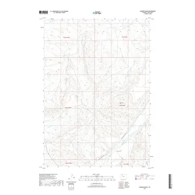
2017 Map of Sleepers Ranch
USGS Topo · Published 2017About this map
The Greybull River valley serves as the primary corridor of activity in this part of Park County, where the eponymous Sleepers Ranch is situated near the river's northern banks. This landscape is defined by the sharp contrast between the fertile river bottom and the high desert terrain to the north. Dominating the central portion of the map is the Meeteetse Rim, an elevated landform that overlooks a network of seasonal drainages including Dry Cr and S Fork Dry Cr.
Find a feature on this map
15 named features on this map. Tap any name to fly to it.
Don’t see what you’re looking for? This feature index may not catch every label — zoom into the map to look around manually.
Map Details
Editions of this 2017 Sleepers Ranch Map
This is the sole edition of this map. No revisions or reprints were ever made.
Other maps of this area

1911 · Meeteetse
USGS Topo · 1:62,500

1911 · Oregon Basin
USGS Topo · 1:62,500

1913 · Oregon Basin
USGS Topo · 1:62,500

1913 · Meeteetse
USGS Topo · 1:62,500

1951 · Y U Bench NW
USGS Topo · 1:24,000

1951 · Sheets Flat
USGS Topo · 1:24,000

1951 · Wilson Spring
USGS Topo · 1:24,000

1955 · Cody
USGS Topo · 1:250,000

1958 · Cody
USGS Topo · 1:250,000

1962 · Cody
USGS Topo · 1:250,000