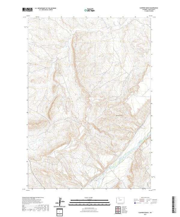
2021 Map of Sleepers Ranch
USGS Topo · Published 2021About this map
The Greybull River cuts through the southeastern corner of this high-plains landscape, serving as the primary hydrological anchor for the region. Much of the terrain is defined by the prominent Meeteetse Rim, which creates a natural barrier across the central and eastern portions of the map. The drainage patterns are dominated by the Dry Cr and its tributary, the S Fork Dry Cr, which carve through the high basins of the Bighorn Basin area. Transportation in this part of Park County is dictated by historical routes like the Burlington Meeteetse Rd and Sleeper Rd, which navigate the elevation changes between the river valley and the higher rangeland. The map illustrates a landscape primarily shaped by grazing and water access, typical of Wyoming's interior basins.
Find a feature on this map
14 named features on this map. Tap any name to fly to it.
Don’t see what you’re looking for? This feature index may not catch every label — zoom into the map to look around manually.
Map Details
Editions of this 2021 Sleepers Ranch Map
This is the sole edition of this map. No revisions or reprints were ever made.
Other maps of this area

1911 · Meeteetse
USGS Topo · 1:62,500

1911 · Oregon Basin
USGS Topo · 1:62,500

1913 · Oregon Basin
USGS Topo · 1:62,500

1913 · Meeteetse
USGS Topo · 1:62,500

1951 · Y U Bench NW
USGS Topo · 1:24,000

1951 · Sheets Flat
USGS Topo · 1:24,000

1951 · Wilson Spring
USGS Topo · 1:24,000

1955 · Cody
USGS Topo · 1:250,000

1958 · Cody
USGS Topo · 1:250,000

1962 · Cody
USGS Topo · 1:250,000