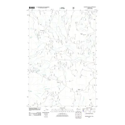
2011 Map of Sleeping Beauty
USGS Topo · Published 2011About this map
Sleeping Beauty Lookout stands as a prominent vantage point over a complex network of forest roads and waterways in the southern Cascades. The landscape is defined by its high-altitude water bodies, including Lake Wapiki, Lake Comcomly, and the cluster at Hidden Lakes. These features, combined with established recreation sites like Little Goose Campground and Smoky Creek Campground, indicate a region managed for both timber resources and backcountry access. Local landmarks such as Tire Junction and Eckhart Point mark key navigational nodes for those traversing the ridges. The drainage patterns of Trout Lake Creek and Little Goose Creek illustrate the steep vertical relief of the territory, while Langfield Falls provides a specific point of geographic interest within the Mosquito Creek drainage.
Find a feature on this map
27 named features on this map. Tap any name to fly to it.
Don’t see what you’re looking for? This feature index may not catch every label — zoom into the map to look around manually.
Map Details
Editions of this 2011 Sleeping Beauty Map
This is the sole edition of this map. No revisions or reprints were ever made.
Other maps of this area

1926 · Steamboat Mtn
USGS Topo · 1:125,000

1926 · Hood River
USGS Topo · 1:125,000

1929 · Hood River
USGS Topo · 1:125,000

1931 · Steamboat Mtn
USGS Topo · 1:125,000

1950 · Yakima
USGS Topo · 1:250,000

1953 · The Dalles
USGS Topo · 1:250,000

1956 · The Dalles
USGS Topo · 1:250,000

1957 · The Dalles
USGS Topo · 1:250,000

1957 · Wind River
USGS Topo · 1:62,500

1957 · Willard
USGS Topo · 1:62,500