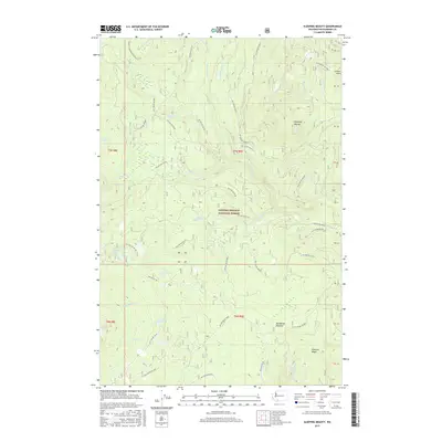
2017 Map of Sleeping Beauty
USGS Topo · Published 2017About this map
Gifford Pinchot National Forest defines the character of this 2017 survey, where a high-elevation landscape is navigated by a complex network of forest development roads. The terrain is marked by distinctive prominences like Sleeping Beauty and Peterson Ridge, alongside the volcanic and glacial topography of the Twin Buttes. Water is a defining element throughout the quadrangle, from the concentrated clusters of Surprise Lakes and Hidden Lake to the course of Trout Lake Creek and the vertical drop of Langfield Falls. This modern record of the Cascade Range shows the preservation of significant recreational infrastructure, notably the Pacific Crest National Scenic Trail as it winds through the western half. The map also captures specialized mountain meadows such as Grand Meadows and Deadhorse Meadow, which have served as seasonal landmarks for travelers and forest managers for generations.
Find a feature on this map
49 named features on this map. Tap any name to fly to it.
Don’t see what you’re looking for? This feature index may not catch every label — zoom into the map to look around manually.
Map Details
Editions of this 2017 Sleeping Beauty Map
This is the sole edition of this map. No revisions or reprints were ever made.
Other maps of this area

1926 · Steamboat Mtn
USGS Topo · 1:125,000

1926 · Hood River
USGS Topo · 1:125,000

1929 · Hood River
USGS Topo · 1:125,000

1931 · Steamboat Mtn
USGS Topo · 1:125,000

1950 · Yakima
USGS Topo · 1:250,000

1953 · The Dalles
USGS Topo · 1:250,000

1956 · The Dalles
USGS Topo · 1:250,000

1957 · The Dalles
USGS Topo · 1:250,000

1957 · Wind River
USGS Topo · 1:62,500

1957 · Willard
USGS Topo · 1:62,500