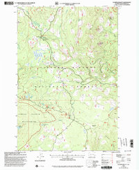
1998 Map of Sleeping Beauty
USGS Topo · Published 2003About this map
The Pacific Crest National Scenic Trail winds through this high-altitude landscape of the Cascades, marking a corridor of recreation and conservation within the Gifford Pinchot National Forest. This late-1990s revision reveals a land defined by its volcanic geology and alpine hydrology, where peaks like East Twin Butte and the namesake Sleeping Beauty spire rise above a network of drainages including Mosquito Creek and Trout Lake Creek. The map documents a shift toward managed recreational use, evidenced by the Little Goose Horse Camp and the preservation of cultural landmarks like the Basket Tree Interpretive Site.
Find a feature on this map
36 named features on this map. Tap any name to fly to it.
Don’t see what you’re looking for? This feature index may not catch every label — zoom into the map to look around manually.
Map Details
Editions of this 1998 Sleeping Beauty Map
This is the sole edition of this map. No revisions or reprints were ever made.
Other maps of this area

1926 · Steamboat Mtn
USGS Topo · 1:125,000

1926 · Hood River
USGS Topo · 1:125,000

1929 · Hood River
USGS Topo · 1:125,000

1931 · Steamboat Mtn
USGS Topo · 1:125,000

1950 · Yakima
USGS Topo · 1:250,000

1953 · The Dalles
USGS Topo · 1:250,000

1956 · The Dalles
USGS Topo · 1:250,000

1957 · The Dalles
USGS Topo · 1:250,000

1957 · Wind River
USGS Topo · 1:62,500

1957 · Willard
USGS Topo · 1:62,500