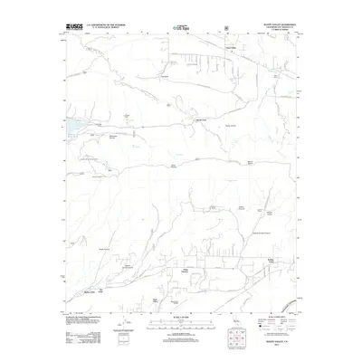
2012 Map of Sleepy Valley
USGS Topo · Published 2012About this map
Leona Valley and Agua Dulce anchor this northern Los Angeles County landscape, where the high desert meets the northern slopes of the Sierra Pellona mountains. The map documents a transition between established agricultural ranching and modern aviation, centered around the Agua Dulce Airpark and numerous family-named properties like Ritter Ranch, Los Robles Ranch, and Annan Ranch. In the west, the Bouquet Reservoir provides a significant water feature near the Sierra Pellona Mtwy. High points such as Mount McDill and the Pelona Lookout overlook a network of canyons, including Martindale Canyon and Spade Canyon. This 2012 survey captures the rural residential character of the region, specifically in areas like Sleepy Valley and The Oaks, while preserving the locations of springs and campgrounds such as Artesian Spring Campgrounds and Big Oak Spring.
Find a feature on this map
80 named features on this map. Tap any name to fly to it.
Don’t see what you’re looking for? This feature index may not catch every label — zoom into the map to look around manually.
Map Details
Editions of this 2012 Sleepy Valley Map
This is the sole edition of this map. No revisions or reprints were ever made.
Other maps of this area

1900 · Tujunga
USGS Topo · 1:62,500

1900 · Fernando
USGS Topo · 1:62,500

1901 · Southern California Sheet No. 1
USGS Topo · 1:250,000

1904 · Southern California Sheet No. 1
USGS Topo · 1:250,000

1915 · Elizabeth Lake
USGS Topo · 1:125,000

1917 · Elizabeth Lake
USGS Topo · 1:125,000

1929 · Lang
USGS Topo · 1:24,000

1930 · Ravenna
USGS Topo · 1:24,000

1931 · Del Sur
USGS Topo · 1:24,000

1932 · Red Rover
USGS Topo · 1:24,000