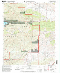
1995 Map of Sleepy Valley
USGS Topo · Published 1999About this map
The San Andreas Rift Zone slices through the northern portion of this landscape, defining the geologic character of Leona Valley and Portal Ridge. This 1995 revision reveals a rugged intersection of tectonic forces and mid-century ranching heritage within the Angeles National Forest. Small, private enclaves like Sleepy Valley and The Oaks are situated along the southern drainage of Spade Canyon, while family-named holdings such as Annan Ranch and Lannan Ranch occupy the canyons to the east.
Find a feature on this map
57 named features on this map. Tap any name to fly to it.
Don’t see what you’re looking for? This feature index may not catch every label — zoom into the map to look around manually.
Map Details
Editions of this 1995 Sleepy Valley Map
This is the sole edition of this map. No revisions or reprints were ever made.
Other maps of this area

1900 · Tujunga
USGS Topo · 1:62,500

1900 · Fernando
USGS Topo · 1:62,500

1901 · Southern California Sheet No. 1
USGS Topo · 1:250,000

1904 · Southern California Sheet No. 1
USGS Topo · 1:250,000

1915 · Elizabeth Lake
USGS Topo · 1:125,000

1917 · Elizabeth Lake
USGS Topo · 1:125,000

1929 · Lang
USGS Topo · 1:24,000

1930 · Ravenna
USGS Topo · 1:24,000

1931 · Del Sur
USGS Topo · 1:24,000

1932 · Red Rover
USGS Topo · 1:24,000