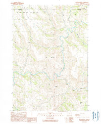
1990 Map of Slickear Mtn
USGS Topo · Published 1990About this map
The Umatilla National Forest defines this high-elevation landscape where the boundaries of Morrow Co and Grant Co meet. The terrain is characterized by a complex system of deep drainage basins, most notably where the North Fork John Day River and the Middle Fork John Day River converge into the main branch of the John Day River. This confluence represents a critical hydrological junction in the region, surrounded by prominent peaks such as Slickear Mtn and Murphy Mtn. The map reveals a remote environment shaped by seasonal watercourses like Potamus Creek and Elder Creek, which carve out numerous named passages including Slickear Canyon and Wrightman Canyon. Navigational waypoints such as Fourmile Gap and Twomile Gap indicate the historical routes through the rugged divide between the various river forks.
Find a feature on this map
31 named features on this map. Tap any name to fly to it.
Don’t see what you’re looking for? This feature index may not catch every label — zoom into the map to look around manually.
Map Details
Editions of this 1990 Slickear Mtn Map
This is the sole edition of this map. No revisions or reprints were ever made.
Other maps of this area

1950 · Ritter
USGS Topo · 1:62,500

1951 · Monument
USGS Topo · 1:62,500

1952 · Ritter
USGS Topo · 1:62,500

1953 · Pendleton
USGS Topo · 1:250,000

1955 · Canyon City
USGS Topo · 1:250,000

1956 · Pendleton
USGS Topo · 1:250,000

1959 · Canyon City
USGS Topo · 1:250,000

1969 · Lake Penland
USGS Topo · 1:24,000

1969 · Thompson Flat
USGS Topo · 1:24,000

1969 · Madison Butte
USGS Topo · 1:24,000