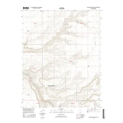
2017 Map of Slickhorn Canyon East
USGS Topo · Published 2017About this map
San Juan River flows through the southwestern corner of this survey, carving a path past the churning waters of Government Rapids. The landscape is dominated by massive elevated plateaus and distinctive rock formations, including Douglas Mesa and the uniquely named Cowboy Hat. A portion of the Glen Canyon National Recreation Area is visible, protecting the dramatic vertical relief of Slickhorn Canyon as it cuts through Polly Mesa. Human impact is minimal and concentrated on remote access routes like Johns Canyon Road and Point Lookout Rd, which traverse the high ground near Cedar Mesa. The map captures a high-desert wilderness characterized by sharp escarpments and broad flats such as Hat Flat, located near the northern landmark of Hat Rock.
Find a feature on this map
30 named features on this map. Tap any name to fly to it.
Don’t see what you’re looking for? This feature index may not catch every label — zoom into the map to look around manually.
Map Details
Editions of this 2017 Slickhorn Canyon East Map
This is the sole edition of this map. No revisions or reprints were ever made.
Other maps of this area

1886 · Henry Mountains
USGS Topo · 1:250,000

1886 · Abajo
USGS Topo · 1:250,000

1892 · Abajo
USGS Topo · 1:250,000

1892 · Henry Mountains
USGS Topo · 1:250,000

1893 · Abajo
USGS Topo · 1:250,000

1954 · Clay Hills 1 NW
USGS Topo · 1:24,000

1956 · Escalante
USGS Topo · 1:250,000

1956 · Cortez
USGS Topo · 1:250,000

1958 · Cortez
USGS Topo · 1:250,000

1959 · Cortez
USGS Topo · 1:250,000