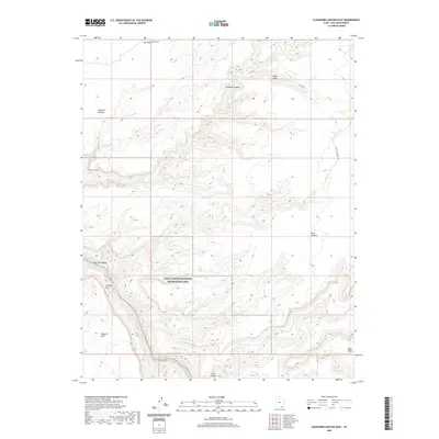
2020 Map of Slickhorn Canyon East
USGS Topo · Published 2020About this map
Glen Canyon National Recreation Area occupies the southern and central portions of this map, where the high desert plateaus break into complex canyon systems. The landscape is defined by its massive mesas and deep incisions, notably Slickhorn Canyon and Johns Canyon, which carve through the rock toward the San Juan River. Cultural features are sparse, represented primarily by the Point Lookout Rd and various remote paths like the Trail that crosses the southern reaches. The map identifies distinctive rock formations such as Hat Rock and Cowboy Hat on Hat Flat, serving as important landmarks for navigation in the San Juan County backcountry. Ranching history is reflected in names like Slickhorn Pasture, while the high elevations of Polly Mesa, Douglas Mesa, and Cedar Mesa overlook the wide San Juan Valley.
Find a feature on this map
16 named features on this map. Tap any name to fly to it.
Don’t see what you’re looking for? This feature index may not catch every label — zoom into the map to look around manually.
Map Details
Editions of this 2020 Slickhorn Canyon East Map
This is the sole edition of this map. No revisions or reprints were ever made.
Other maps of this area

1886 · Henry Mountains
USGS Topo · 1:250,000

1886 · Abajo
USGS Topo · 1:250,000

1892 · Abajo
USGS Topo · 1:250,000

1892 · Henry Mountains
USGS Topo · 1:250,000

1893 · Abajo
USGS Topo · 1:250,000

1954 · Clay Hills 1 NW
USGS Topo · 1:24,000

1956 · Escalante
USGS Topo · 1:250,000

1956 · Cortez
USGS Topo · 1:250,000

1958 · Cortez
USGS Topo · 1:250,000

1959 · Cortez
USGS Topo · 1:250,000