Loading...
Loading map...2024 Map of Slidell
USGS Topo · Published 2024About this map
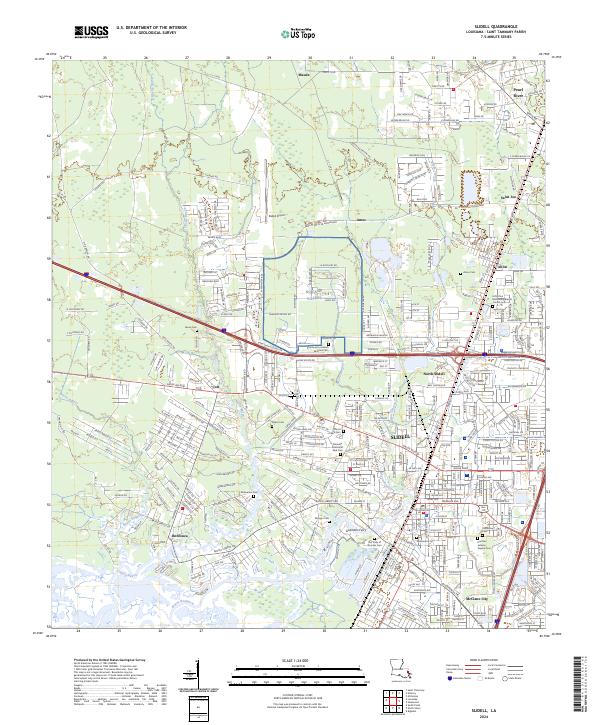
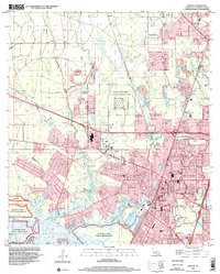
Slidell is the central hub of this St. Tammany Parish landscape, where the urban street grid meets the sprawling wetlands of the Big Branch Marsh National Wildlife Refuge. The map details a complex transition between developed neighborhoods and the intricate waterways of Bayou Bonfouca, Bayou Liberty, and the eastern boundary formed by the Pearl River. Several distinct settlements surround the city, including North Slidell, Alton, Saint Joe, and McClane City.
Find a feature on this map
402 named features on this map. Tap any name to fly to it.
Don’t see what you’re looking for? This feature index may not catch every label — zoom into the map to look around manually.
Map Details
Date Portrayed2024
Date Published2024
PublisherU.S. Geological Survey
Map TypeTopographic
Scale1:24000
Physical Dimensions24 x 29 inches
Editions of this 2024 Slidell Map
This is the sole edition of this map. No revisions or reprints were ever made.
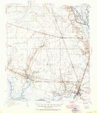
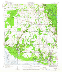
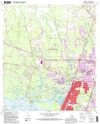
Historical Maps of Abney Estates Through Time
6 maps found

Featured Locations
Source Details
SourceU.S. Geological Survey
CopyrightPublic Domain