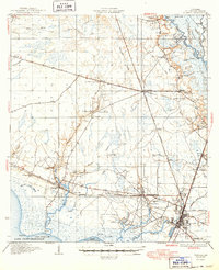
1935 Map of Slidell
USGS Topo · Published 1949About this map
Lake Pontchartrain defines the southern edge of this landscape, where the Gulf Mobile and Northern railroad connects the growing hub of Slidell to the surrounding piney woods and bayous. In the early 1930s, the region was a complex network of water and rail, with the West Pearl River and its intricate sloughs like Maple Slough and Ernest Slough dominating the eastern boundary. The map reveals a transition from these wetlands to established inland communities such as Lacombe and Hickory.
Find a feature on this map
68 named features on this map. Tap any name to fly to it.
Don’t see what you’re looking for? This feature index may not catch every label — zoom into the map to look around manually.
Map Details
Editions of this 1935 Slidell Map
3 editions found
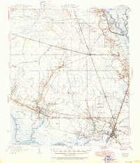
Other maps of this area

1891 · Spanish Fort
USGS Topo · 1:62,500

1892 · Chef Menteur
USGS Topo · 1:62,500

1893 · Rigolets
USGS Topo · 1:62,500

1914 · Nicholson
USGS Topo · 1:62,500

1921 · Nicholson
USGS Topo · 1:62,500

1935 · Slidell
USGS Topo · 1:62,500

1935 · Covington
USGS Topo · 1:62,500

1936 · North Shore
USGS Topo · 1:31,680

1936 · South Point
USGS Topo · 1:31,680

1936 · Chef Menteur
USGS Topo · 1:62,500