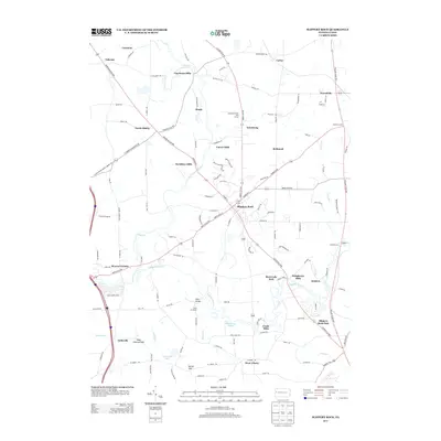
2013 Map of Slippery Rock
USGS Topo · Published 2013About this map
Slippery Rock serves as the central hub of this northern Butler County landscape, situated at the confluence of several major transit corridors including the Mercer Butler Pike and New Castle Rd. The geography is defined by the winding course of Slippery Rock Cr and its tributaries, such as Wolf Cr and Black Run. This map reveals a distinct pattern of historical industry through its numerous named mill sites, including Courtneys Mills, Currys Mills, Christleys Mills, and Crolls Mills, which likely formed the early economic foundations for the surrounding agricultural community. Distinctive glacial features are also noted, such as the West Liberty Esker and a Kettle Hole near Tamarack Lake, providing a rare topographic record of the area's geological history. From the borough of West Liberty in the south to the small clusters of North Liberty and Forestville, the map provides a look at the rural-academic interface of this region.
Find a feature on this map
132 named features on this map. Tap any name to fly to it.
Don’t see what you’re looking for? This feature index may not catch every label — zoom into the map to look around manually.
Map Details
Editions of this 2013 Slippery Rock Map
This is the sole edition of this map. No revisions or reprints were ever made.
Other maps of this area

1908 · Zelienople
USGS Topo · 1:62,500

1909 · Butler
USGS Topo · 1:62,500

1910 · Zelienople
USGS Topo · 1:62,500

1910 · Hilliards
USGS Topo · 1:62,500

1911 · Butler
USGS Topo · 1:62,500

1912 · Hilliards
USGS Topo · 1:62,500

1913 · Mercer
USGS Topo · 1:62,500

1939 · Mercer
USGS Topo · 1:62,500

1943 · Mercer
USGS Topo · 1:62,500

1944 · Hilliards
USGS Topo · 1:62,500