2023 Map of Slippery Rock
USGS Topo · Published 2023About this map
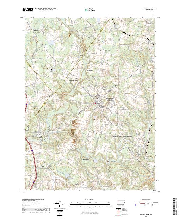
Slippery Rock University dominates the center of this landscape, marking a transition from the dense educational campus to a surrounding terrain defined by water and glacial history. The flow of Wolf Creek and Slippery Rock Creek dictates the placement of early industry, evidenced by a string of historic milling sites including Courtneys Mills, Christleys Mills, Doughertys Mills, and Crolls Mills. These settlements represent the early economic backbone of the region where Butler, Mercer, and Lawrence counties converge.
Find a feature on this map
139 named features on this map. Tap any name to fly to it.
Don’t see what you’re looking for? This feature index may not catch every label — zoom into the map to look around manually.
Map Details
Editions of this 2023 Slippery Rock Map
This is the sole edition of this map. No revisions or reprints were ever made.
Historical Maps of Keisters Through Time
Featured Locations
- Slippery Rock, PA
- Slippery Rock Township, PA
- West Liberty, PA
- Plain Grove Township, PA
- Liberty Township, PA