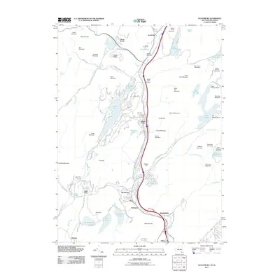
2011 Map of Sloatsburg
USGS Topo · Published 2011About this map
The Ramapo River corridor serves as the primary artery through this mountainous region of Ramapo at the start of the twenty-first century. Settlement is concentrated along the river valley, where the historic communities of Sloatsburg and Hillburn are connected by a network of local roads such as Sterling Ave and Post Rd. To the north, the private enclave of Tuxedo Park surrounds Tuxedo Lake, with the Saint Mary's in Tuxedo Churchyard serving as a significant local landmark.
Find a feature on this map
114 named features on this map. Tap any name to fly to it.
Don’t see what you’re looking for? This feature index may not catch every label — zoom into the map to look around manually.
Map Details
Editions of this 2011 Sloatsburg Map
This is the sole edition of this map. No revisions or reprints were ever made.
Other maps of this area

1891 · Greenwood Lake
USGS Topo · 1:62,500

1891 · Ramapo
USGS Topo · 1:62,500

1893 · Greenwood Lake
USGS Topo · 1:62,500

1893 · Ramapo
USGS Topo · 1:62,500

1902 · Schunemunk
USGS Topo · 1:62,500

1903 · Greenwood Lake
USGS Topo · 1:62,500

1906 · Goshen
USGS Topo · 1:62,500

1908 · Goshen
USGS Topo · 1:62,500

1910 · Ramapo
USGS Topo · 1:62,500

1910 · Greenwood Lake
USGS Topo · 1:62,500