2023 Map of Sloatsburg
USGS Topo · Published 2023About this map
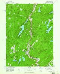
Sloatsburg and Tuxedo Park serve as central hubs in this mountain landscape, where the Ramapo River cuts a deep corridor through the highlands. The map highlights the complex geography of the region, from the dense residential developments around Tuxedo Lake to the scattered settlements of Eagle Valley and Sterlington. Local heritage is anchored by landmarks such as the Saint Elizabeth Memorial Chapel and Saint Marys In-The-Tuxedo Church, which reflect the community's established history along the valley floor. To the east, the terrain rises toward significant summits like Parker Cabin Mountain and Hogencamp Mountain, while the numerous water bodies, including Lake Sebago and Potake Pond, define the recreation-rich landscape. The intricate network of local roads like Sterling Mine Rd and Seven Lakes Dr reveals how the topography has dictated transportation patterns, weaving between peaks such as Wildcat Mountain and Daters Mountain as the valley opens south toward Hillburn and Montebello.
Find a feature on this map
146 named features on this map. Tap any name to fly to it.
Don’t see what you’re looking for? This feature index may not catch every label — zoom into the map to look around manually.
Map Details
Editions of this 2023 Sloatsburg Map
This is the sole edition of this map. No revisions or reprints were ever made.