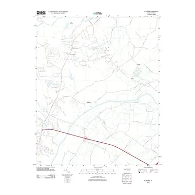
2010 Map of Slocomb
USGS Topo · Published 2010About this map
The Cape Fear River and Little River converge in this portion of Cumberland County, defining a landscape shaped by water and small rural settlements. The community of Slocomb sits near the river bend, while the small hamlets of Lane and Carlos are located further east toward the edge of the survey area. This era of local geography is characterized by several small private reservoirs and dammed features, including Clarks Lake, Ennis Pond, and Smiths Lake, which dot the northern half of the quadrangle. The infrastructure reflects a transition toward modern residential development while maintaining older rural pathways like Carver Falls Rd and Slocomb Rd. To the west, Carvers Creek winds through the terrain, illustrating the dense network of tributaries that feed the larger river system in this part of North Carolina.
Find a feature on this map
48 named features on this map. Tap any name to fly to it.
Don’t see what you’re looking for? This feature index may not catch every label — zoom into the map to look around manually.
Map Details
Editions of this 2010 Slocomb Map
This is the sole edition of this map. No revisions or reprints were ever made.
Other maps of this area

1948 · Fayetteville
USGS Topo · 1:62,500

1948 · Slocomb
USGS Topo · 1:24,000

1949 · Vander
USGS Topo · 1:24,000

1950 · Fayetteville
USGS Topo · 1:24,000

1950 · Manchester
USGS Topo · 1:24,000

1950 · Slocomb
USGS Topo · 1:24,000

1953 · Raleigh
USGS Topo · 1:250,000

1954 · Raleigh
USGS Topo · 1:250,000

1956 · Anderson Creek
USGS Topo · 1:24,000

1956 · Bunnlevel
USGS Topo · 1:24,000