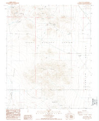
1988 Map of Slocum Mtn
USGS Topo · Published 1988About this map
The high desert of San Bernardino County is dominated here by the expansive Naval Weapons Center and the Naval Reservation Boundary. This 1980s topography documents a landscape defined by significant mineral exploration and early ranching history within the Mojave. Slocum Mountain and Granite Mountain rise above the arid plains of Grass Valley and Superior Valley (Depression), punctuated by numerous mining Prospect labels and a designated Mine.
Find a feature on this map
18 named features on this map. Tap any name to fly to it.
Don’t see what you’re looking for? This feature index may not catch every label — zoom into the map to look around manually.
Map Details
Editions of this 1988 Slocum Mtn Map
This is the sole edition of this map. No revisions or reprints were ever made.
Other maps of this area

1915 · Searles Lake
USGS Topo · 1:250,000

1947 · Trona
USGS Topo · 1:250,000

1948 · Trona
USGS Topo · 1:250,000

1953 · Trona
USGS Topo · 1:250,000

1954 · Pilot Knob
USGS Topo · 1:62,500

1954 · Cuddeback Lake
USGS Topo · 1:62,500

1955 · Opal Mountain
USGS Topo · 1:62,500

1956 · Fremont Peak
USGS Topo · 1:62,500

1957 · Trona
USGS Topo · 1:250,000

1960 · Trona
USGS Topo · 1:250,000