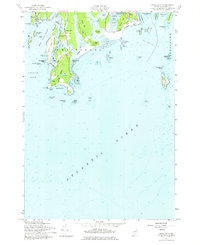
1957 Map of Small Point
USGS Topo · Published 1974About this map
Fort Baldwin and the surrounding U S Mil Res Fort Baldwin anchor the coastal defenses of this mid-century maritime landscape where the Kennebec R meets the Atlantic Ocean. The settlement of Small Point occupies the peninsula's southern tip, characterized by a complex network of coastal features like Small Point Harbor and Bald Head Cove. The mapping of this area, revised in 1957, reveals a geography defined by tidal dynamics, with extensive Tidal Flats stretching between Morse Hill and Sabino Hill. Inland water bodies such as Spirit Pond and Silver Lake contrast with the exposed Atlantic coastline at Hunnewell Beach and Head Beach. Notable navigation markers and historical structures, including several Lights and the US CG Sta at Popham Beach, emphasize the region's enduring importance to Maine's maritime safety and military history.
Find a feature on this map
71 named features on this map. Tap any name to fly to it.
Don’t see what you’re looking for? This feature index may not catch every label — zoom into the map to look around manually.
Map Details
Editions of this 1957 Small Point Map
3 editions found
Other maps of this area

1893 · Small Point
USGS Topo · 1:62,500

1893 · Boothbay
USGS Topo · 1:62,500

1894 · Bath
USGS Topo · 1:62,500

1919 · Small Point
USGS Topo · 1:62,500

1920 · Bath
USGS Topo · 1:62,500

1941 · Boothbay
USGS Topo · 1:62,500

1943 · Boothbay
USGS Topo · 1:62,500

1944 · Boothbay
USGS Topo · 1:62,500

1944 · Small Point
USGS Topo · 1:62,500

1945 · Bath
USGS Topo · 1:62,500