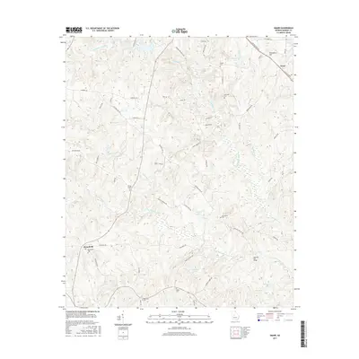
2017 Map of Smarr
USGS Topo · Published 2017About this map
Providence Hill rises above the rural landscape of Monroe County, overlooking a network of creek branches and family-named cemeteries that define this part of central Georgia. The settlement of Smarr sits at the junction of Old Rumble Rd and Old Macon Rd, while the community of Russellville occupies the western portion of the quadrangle. The map is heavily marked by small-scale water features and private reservoirs, including McCook Lake, Abernathy Lake, and Hart Lake, which feed into the larger drainage systems of Tobesofkee Creek and its many tributaries.
Find a feature on this map
62 named features on this map. Tap any name to fly to it.
Don’t see what you’re looking for? This feature index may not catch every label — zoom into the map to look around manually.
Map Details
Editions of this 2017 Smarr Map
This is the sole edition of this map. No revisions or reprints were ever made.
Other maps of this area

1951 · Yatesville
USGS Topo · 1:62,500

1951 · Forsyth
USGS Topo · 1:62,500

1951 · Barnesville
USGS Topo · 1:62,500

1953 · Atlanta
USGS Topo · 1:250,000

1953 · Athens
USGS Topo · 1:250,000

1955 · Phenix City
USGS Topo · 1:250,000

1956 · Bolingbroke
USGS Topo · 1:62,500

1957 · Phenix City
USGS Topo · 1:250,000

1957 · Macon
USGS Topo · 1:250,000

1957 · Atlanta
USGS Topo · 1:250,000