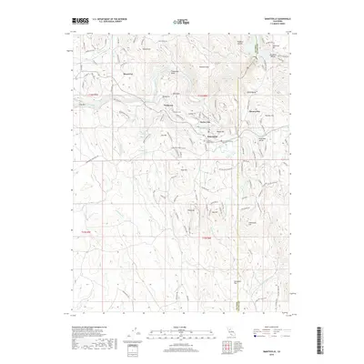
2018 Map of Smartsville
USGS Topo · Published 2018About this map
Smartsville and the surrounding gold-country flats occupy this portion of the northern Sierra foothills, where the Yuba Co and Nevada Co line meets at the Yuba River. The landscape is defined by its historic hydraulic mining legacy, evidenced by the numerous "flat" settlements including Sicard Flat, Sucker Flat, Mooney Flat, and Timbuctoo. Water management systems, such as Farm Ditch and the Union Reservoir, underscore the importance of water infrastructure in this region's development.
Find a feature on this map
131 named features on this map. Tap any name to fly to it.
Don’t see what you’re looking for? This feature index may not catch every label — zoom into the map to look around manually.
Map Details
Editions of this 2018 Smartsville Map
This is the sole edition of this map. No revisions or reprints were ever made.
Other maps of this area

1888 · Smartsville
USGS Topo · 1:125,000

1891 · Smartsville
USGS Topo · 1:125,000

1892 · Smartsville
USGS Topo · 1:125,000

1894 · Smartsville
USGS Topo · 1:125,000

1895 · Smartsville
USGS Topo · 1:125,000

1910 · Wheatland
USGS Topo · 1:31,680

1911 · Browns Valley
USGS Topo · 1:31,680
1912 · Prairie Creek
USGS Topo · 1:31,680

1915 · Spenceville
USGS Topo · 1:31,680

1941 · Bangor
USGS Topo · 1:62,500