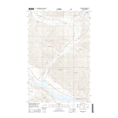
2014 Map of Smeads Bench
USGS Topo · Published 2014About this map
Smeads Bench sits above the wide valley where the Bull River meets the Clark Fork in northwestern Montana. This 2014 survey captures a landscape defined by the drainage systems of the Kanisku National Forest, with the Cabinet Mountains rising to the northeast. The geography is carved by numerous named drainages, including Napoleon Gulch, Ellis Gulch, and Thirteen Gulch, which feed into the primary river systems. Transportation in the area is focused along the river corridors, following the path of Bull River Rd and Railroad Rd. Higher elevations are marked by prominent landmarks such as Government Mtn, Pilik Ridge, and the distinctive Chimney Rock. The map illustrates the division of public land and private parcels across four townships, including t27n r33w, showing the enduring footprint of the Public Land Survey System in this heavily forested mountain region.
Find a feature on this map
30 named features on this map. Tap any name to fly to it.
Don’t see what you’re looking for? This feature index may not catch every label — zoom into the map to look around manually.
Map Details
Editions of this 2014 Smeads Bench Map
This is the sole edition of this map. No revisions or reprints were ever made.
Other maps of this area

1920 · Libby
USGS Topo · 1:125,000

1930 · Libby
USGS Topo · 1:125,000

1932 · Libby
USGS Topo · 1:125,000

1932 · Trout Creek
USGS Topo · 1:125,000

1935 · Trout Creek
USGS Topo · 1:125,000

1936 · Trout Creek
USGS Topo · 1:125,000

1956 · Wallace
USGS Topo · 1:250,000

1957 · Kalispell
USGS Topo · 1:250,000

1960 · Kalispell
USGS Topo · 1:250,000

1960 · Wallace
USGS Topo · 1:250,000