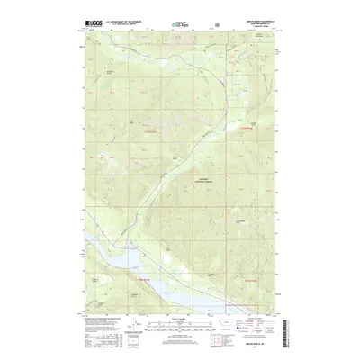
2017 Map of Smeads Bench
USGS Topo · Published 2017About this map
Cabinet Gorge Reservoir dominates the southern landscape of this Sanders County region, where the Clark Fork river was harnessed for hydroelectric power. The map detail reflects a wilderness character defined by the steep elevation of the Cabinet Mountains and Berray Mountain, with the Kaniksu National Forest boundary encompassing much of the territory. Transportation through this mountain pass relies on the Bull River Rd corridor, which follows the path of the Bull River northward. Local landforms like Smeads Bench and Pilik Ridge provide landmarks for those navigating the numerous gulches, including Napoleon Gulch and Thirteen Gulch, that drain into the reservoir and river systems below. Notable geological features such as Chimney Rock stand out amidst the complex topography of the Sanders County backcountry.
Find a feature on this map
31 named features on this map. Tap any name to fly to it.
Don’t see what you’re looking for? This feature index may not catch every label — zoom into the map to look around manually.
Map Details
Editions of this 2017 Smeads Bench Map
This is the sole edition of this map. No revisions or reprints were ever made.
Other maps of this area

1920 · Libby
USGS Topo · 1:125,000

1930 · Libby
USGS Topo · 1:125,000

1932 · Libby
USGS Topo · 1:125,000

1932 · Trout Creek
USGS Topo · 1:125,000

1935 · Trout Creek
USGS Topo · 1:125,000

1936 · Trout Creek
USGS Topo · 1:125,000

1956 · Wallace
USGS Topo · 1:250,000

1957 · Kalispell
USGS Topo · 1:250,000

1960 · Kalispell
USGS Topo · 1:250,000

1960 · Wallace
USGS Topo · 1:250,000