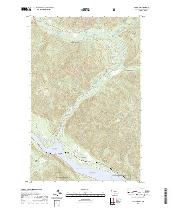
2024 Map of Smeads Bench
USGS Topo · Published 2024About this map
Smeads Bench sits as a high terrace overlooking the southern reaches of the Cabinet Gorge Reservoir, where the Bull River meets the inundated valley. This modern survey illustrates a landscape defined by the intersection of the Cabinet Mountains and Coeur d'Alene Mountains, with deep drainage basins like Ellis Gulch and Thirteen Gulch carving through the steep terrain. Much of the area is contained within the Kaniksu National Forest, showing a network of specialized access routes such as the Dry Creek Trl and Pillick Ridge Trl. The map details the transition from the waterway to the high peaks, including Government Mtn and the prominent Chimney Rock. Development is concentrated primarily along the Bull River Rd corridor and near the shoreline, where small residential roads like Prichard Ln and Russell Ln appear alongside the vital transport path of Railroad Rd.
Find a feature on this map
42 named features on this map. Tap any name to fly to it.
Don’t see what you’re looking for? This feature index may not catch every label — zoom into the map to look around manually.
Map Details
Editions of this 2024 Smeads Bench Map
This is the sole edition of this map. No revisions or reprints were ever made.
Other maps of this area

1920 · Libby
USGS Topo · 1:125,000

1930 · Libby
USGS Topo · 1:125,000

1932 · Libby
USGS Topo · 1:125,000

1932 · Trout Creek
USGS Topo · 1:125,000

1935 · Trout Creek
USGS Topo · 1:125,000

1936 · Trout Creek
USGS Topo · 1:125,000

1956 · Wallace
USGS Topo · 1:250,000

1957 · Kalispell
USGS Topo · 1:250,000

1960 · Kalispell
USGS Topo · 1:250,000

1960 · Wallace
USGS Topo · 1:250,000