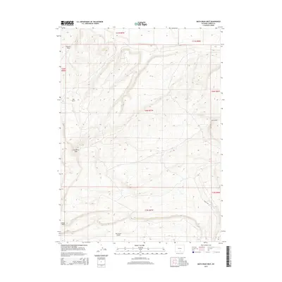
2015 Map of Smith Draw West
USGS Topo · Published 2015About this map
Sheep Mtn and the steep elevation of Hugus Cliff define the southwestern landscape of this Carbon County quadrangle. The terrain is marked by deep incisions from Wild Horse Canyon and Hay Gulch, illustrating the high-altitude drainage patterns of the high plains. In the northern reaches, Fivemile Ridge and Chokecherry Knob rise above the surrounding slopes, while the seasonal watercourse of Smith Draw cuts through the eastern sections. This survey provides a precise look at the township and range grids of the early 21st century, revealing a landscape largely devoid of modern development, instead showing the intricate topography and natural landmarks used by ranchers and hunters for generations in this part of Wyoming.
Find a feature on this map
14 named features on this map. Tap any name to fly to it.
Don’t see what you’re looking for? This feature index may not catch every label — zoom into the map to look around manually.
Map Details
Editions of this 2015 Smith Draw West Map
This is the sole edition of this map. No revisions or reprints were ever made.
Other maps of this area

1953 · Sinclair
USGS Topo · 1:24,000

1953 · Rawlins
USGS Topo · 1:24,000

1954 · Rawlins
USGS Topo · 1:250,000

1956 · Rawlins Peak
USGS Topo · 1:62,500

1956 · Bridger Pass
USGS Topo · 1:62,500

1956 · Bolten Ranch
USGS Topo · 1:62,500

1958 · Rawlins
USGS Topo · 1:250,000

1962 · Rawlins
USGS Topo · 1:250,000

1967 · Rawlins
USGS Topo · 1:250,000
1983 · Coal Mine Ridge
USGS Topo · 1:24,000