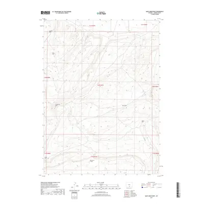
2017 Map of Smith Draw West
USGS Topo · Published 2017About this map
Sheep Mtn and Chokecherry Knob dominate the high-elevation landscape of Carbon County in this western Wyoming study. The terrain is defined by a series of steep drainages, including Smith Draw and Hugus Draw, which cut through the high desert plateau. Large-scale geographic features such as Fivemile Ridge and Hugus Cliff provide significant vertical relief across the quadrangle, illustrating the complex erosion patterns of the region. This 2017 survey details the Bureau of Land Management township and range system, showing the legal land divisions that govern this section of the Great Divide Basin. The map is a critical resource for understanding the water-sculpted topography of Wild Horse Canyon and Hay Gulch in a region where local geography is tied to specific named landmarks.
Find a feature on this map
16 named features on this map. Tap any name to fly to it.
Don’t see what you’re looking for? This feature index may not catch every label — zoom into the map to look around manually.
Map Details
Editions of this 2017 Smith Draw West Map
This is the sole edition of this map. No revisions or reprints were ever made.
Other maps of this area

1953 · Sinclair
USGS Topo · 1:24,000

1953 · Rawlins
USGS Topo · 1:24,000

1954 · Rawlins
USGS Topo · 1:250,000

1956 · Rawlins Peak
USGS Topo · 1:62,500

1956 · Bridger Pass
USGS Topo · 1:62,500

1956 · Bolten Ranch
USGS Topo · 1:62,500

1958 · Rawlins
USGS Topo · 1:250,000

1962 · Rawlins
USGS Topo · 1:250,000

1967 · Rawlins
USGS Topo · 1:250,000
1983 · Coal Mine Ridge
USGS Topo · 1:24,000