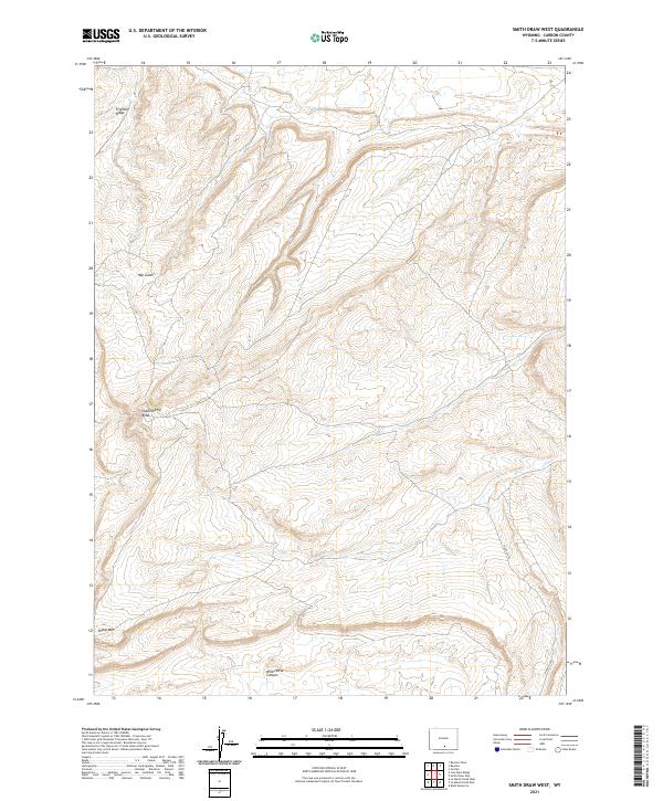
2021 Map of Smith Draw West
USGS Topo · Published 2021About this map
Chokecherry Knob stands as a prominent high point in this high-altitude Carbon County landscape, where deep drainages and ridges define the terrain west of the Continental Divide. This 2021 digital survey illustrates the complex topography of the Hugus Cliff escarpment and the winding corridor of Wild Horse Canyon. The map area is largely defined by public land management and the checkerboard of township and range lines, including t20n r87w and t19n r87w. The absence of major settlements emphasizes the isolation of the high desert, where features like Fivemile Ridge and Sheep Mtn serve as the primary landmarks for navigation across this open country. Geographic details such as Hay Gulch provide insight into the seasonal water drainage patterns essential for grazing and wildlife in this part of Wyoming.
Find a feature on this map
14 named features on this map. Tap any name to fly to it.
Don’t see what you’re looking for? This feature index may not catch every label — zoom into the map to look around manually.
Map Details
Editions of this 2021 Smith Draw West Map
This is the sole edition of this map. No revisions or reprints were ever made.
Other maps of this area

1953 · Sinclair
USGS Topo · 1:24,000

1953 · Rawlins
USGS Topo · 1:24,000

1954 · Rawlins
USGS Topo · 1:250,000

1956 · Rawlins Peak
USGS Topo · 1:62,500

1956 · Bridger Pass
USGS Topo · 1:62,500

1956 · Bolten Ranch
USGS Topo · 1:62,500

1958 · Rawlins
USGS Topo · 1:250,000

1962 · Rawlins
USGS Topo · 1:250,000

1967 · Rawlins
USGS Topo · 1:250,000
1983 · Coal Mine Ridge
USGS Topo · 1:24,000