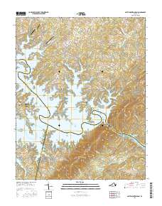
2016 Map of Smith Mountain Dam
USGS Topo · Published 2016About this map
Smith Mountain Dam serves as the central focal point of this landscape, where the waters of Smith Mountain Lake transition into Leesville Lake at the Gap of Smith Mountain. This era of the region is defined by the extensive residential and recreational development along the intricate shorelines, particularly around North Shore and Kasey. The convergence of Bedford, Franklin, and Pittsylvania counties meets near the dam, illustrating a complex tri-county boundary system.
Find a feature on this map
134 named features on this map. Tap any name to fly to it.
Don’t see what you’re looking for? This feature index may not catch every label — zoom into the map to look around manually.
Map Details
Editions of this 2016 Smith Mountain Dam Map
This is the sole edition of this map. No revisions or reprints were ever made.
Other maps of this area

1890 · Roanoke
USGS Topo · 1:125,000

1891 · Roanoke
USGS Topo · 1:125,000

1892 · Lynchburg
USGS Topo · 1:125,000

1921 · Chatham
USGS Topo · 1:48,000

1922 · Callands
USGS Topo · 1:48,000

1923 · Chatham
USGS Topo · 1:62,500

1924 · Callands
USGS Topo · 1:62,500

1944 · Callands
USGS Topo · 1:62,500

1947 · Roanoke
USGS Topo · 1:250,000

1951 · Moneta
USGS Topo · 1:62,500