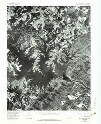
1977 Map of Smith Mountain Dam
USGS Topo · Published 1983About this map
Smith Mountain Dam stands as the central engineering feature of this orthophotoquad, which uses aerial imagery from 1977 to document the complex shoreline of Smith Mountain Lake. The landscape is defined by the confluence of the Roanoke River and the Blackwater River, creating a deeply indented reservoir that surrounds high points like Smith Mountain. This photographic survey provides a clear view of the rural upland terrain before later decades of shoreline development, showing the patchwork of forest and clearings around small settlements such as Dundee and Kasey. To the southeast, the water continues through the dam into Leesville Lake. Local landmarks like Graves Store and the drainages of Carter Creek and Mill Creek help orient those studying the region's mid-century land use and topography.
Find a feature on this map
11 named features on this map. Tap any name to fly to it.
Don’t see what you’re looking for? This feature index may not catch every label — zoom into the map to look around manually.
Map Details
Editions of this 1977 Smith Mountain Dam Map
This is the sole edition of this map. No revisions or reprints were ever made.
Other maps of this area

1890 · Roanoke
USGS Topo · 1:125,000

1891 · Roanoke
USGS Topo · 1:125,000

1892 · Lynchburg
USGS Topo · 1:125,000

1921 · Chatham
USGS Topo · 1:48,000

1922 · Callands
USGS Topo · 1:48,000

1923 · Chatham
USGS Topo · 1:62,500

1924 · Callands
USGS Topo · 1:62,500

1944 · Callands
USGS Topo · 1:62,500

1947 · Roanoke
USGS Topo · 1:250,000

1951 · Moneta
USGS Topo · 1:62,500