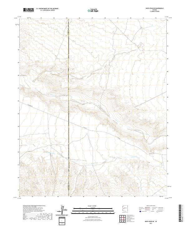
2021 Map of Smith Peak NE
USGS Topo · Published 2021About this map
Date Creek and Bullard Wash carve paths through this arid reach of the Arizona desert along the boundary of La Paz and Yavapai counties. The landscape is defined by its drainage systems and a sparse network of historical thoroughfares, including the well-traveled Wickenburg Rd and Alamo Rd. These routes follow the natural contours of the terrain, providing access across a region primarily characterized by intermittent watercourses like Miller Wash and the upper reaches of Date Creek. The survey illustrates the intersection of these critical desert lifelines and the geopolitical line dividing the two counties, offering a clear view of the topographical isolation and the primitive road network that sustains transit in this part of the Southwest.
Find a feature on this map
14 named features on this map. Tap any name to fly to it.
Don’t see what you’re looking for? This feature index may not catch every label — zoom into the map to look around manually.
Map Details
Editions of this 2021 Smith Peak NE Map
This is the sole edition of this map. No revisions or reprints were ever made.
Other maps of this area

1923 · Signal
USGS Topo · 1:250,000

1942 · Signal
USGS Topo · 1:250,000

1950 · Prescott
USGS Topo · 1:250,000

1954 · Prescott
USGS Topo · 1:250,000

1958 · Prescott
USGS Topo · 1:250,000

1959 · Prescott
USGS Topo · 1:250,000

1960 · Prescott
USGS Topo · 1:250,000

1965 · Prescott
USGS Topo · 1:250,000
1967 · Smith Peak
USGS Topo · 1:24,000
1967 · E.C.P. Peak
USGS Topo · 1:24,000