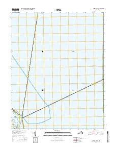
2016 Map of Smith Point
USGS Topo · Published 2016About this map
Potomac River and Chesapeake Bay converge at this maritime crossroads, where the state boundaries of Maryland and Virginia meet in open water. The landscape is dominated by the vast estuary, marked by the transit corridor of the Intracoastal Waterway and the narrow landform of Smith Point. This coastal point serves as a critical navigation marker where Northumberland County, Virginia, meets the maritime reaches of Saint Mary's and Somerset Counties in Maryland. Near the shoreline, small land features like Bamboo Island and the sheltered Rock Hole define the local topography. The map illustrates the limited terrestrial infrastructure at this tip of the Northern Neck, including Smith Point Rd and Tranquility Rd, highlighting the area's role as a transition point between the river's mouth and the open bay.
Find a feature on this map
12 named features on this map. Tap any name to fly to it.
Don’t see what you’re looking for? This feature index may not catch every label — zoom into the map to look around manually.
Map Details
Editions of this 2016 Smith Point Map
This is the sole edition of this map. No revisions or reprints were ever made.
Other maps of this area

1894 · Point Lookout
USGS Topo · 1:62,500

1898 · St. Marys
USGS Topo · 1:125,000

1903 · Bloodsworth Island
USGS Topo · 1:62,500

1906 · St. Marys
USGS Topo · 1:125,000

1912 · Point Lookout
USGS Topo · 1:62,500

1917 · Heathsville
USGS Topo · 1:48,000

1917 · Ewell
USGS Topo · 1:62,500

1937 · Point Lookout
USGS Topo · 1:62,500

1942 · Kedges Straits
USGS Topo · 1:24,000

1942 · Ewell
USGS Topo · 1:24,000