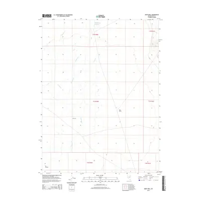
2014 Map of Smith Well
USGS Topo · Published 2014About this map
Ruby Valley defines this high-desert basin in eastern Elko County, where the Franklin River meanders across a landscape shaped by water management and public works history. The map documents the vital water infrastructure of the region, anchored by the Ruby Valley Reservoir Number One and fed by intermittent drainages like Withington Cr and Warden Cr. A singular local landmark, Smith Well, sits central to the valley floor, suggesting the importance of localized water access for ranching and settlement in this arid environment.
Find a feature on this map
14 named features on this map. Tap any name to fly to it.
Don’t see what you’re looking for? This feature index may not catch every label — zoom into the map to look around manually.
Map Details
Editions of this 2014 Smith Well Map
This is the sole edition of this map. No revisions or reprints were ever made.
Other maps of this area

1935 · Halleck
USGS Topo · 1:125,000

1955 · Elko
USGS Topo · 1:250,000

1958 · Elko
USGS Topo · 1:250,000

1962 · Elko
USGS Topo · 1:250,000

1962 · Lamoille
USGS Topo · 1:62,500

1965 · Elko
USGS Topo · 1:250,000

1968 · Franklin Lake NE
USGS Topo · 1:24,000
1984 · Arizona Spring
USGS Topo · 1:24,000
1984 · Ruby City Creek
USGS Topo · 1:24,000

1984 · West of Delcer Buttes
USGS Topo · 1:24,000