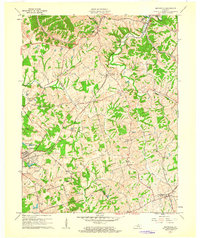
1961 Map of Smithfield
USGS Topo · Published 1962About this map
The Louisville and Nashville Railroad defines the development of this section of the Kentucky landscape, connecting small rail stops like Smithfield, Pendleton, and Sulphur. The terrain is characterized by the divide between the Little Kentucky River to the northeast and the headwaters of Floyds Fork and Harrods Creek to the south and west. This 1961 revision illustrates the post-war transition of the area, featuring a Drive-in Theater near Pendleton alongside long-established local markers like the Sulphur Cem. In the western corner, the growth of La Grange is visible near the Louisville and Nashville Lake, while rural life is anchored by named routes such as Ballard School Road and Fort Pickens Road. Settlement patterns follow the winding creek valleys, with small clusters at Jericho and Tarascon representing the enduring crossroads of Henry County.
Find a feature on this map
38 named features on this map. Tap any name to fly to it.
Don’t see what you’re looking for? This feature index may not catch every label — zoom into the map to look around manually.
Map Details
Editions of this 1961 Smithfield Map
This is the sole edition of this map. No revisions or reprints were ever made.
Other maps of this area

1928 · New Castle
USGS Topo · 1:48,000

1932 · New Castle
USGS Topo · 1:62,500

1932 · La Grange
USGS Topo · 1:62,500

1939 · Bethlehem
USGS Topo · 1:24,000

1948 · Bethlehem
USGS Topo · 1:24,000

1951 · Crestwood
USGS Topo · 1:24,000

1952 · Campbellsburg
USGS Topo · 1:24,000

1953 · Bedford
USGS Topo · 1:24,000

1953 · Bethlehem
USGS Topo · 1:24,000

1954 · Ballardsville
USGS Topo · 1:24,000