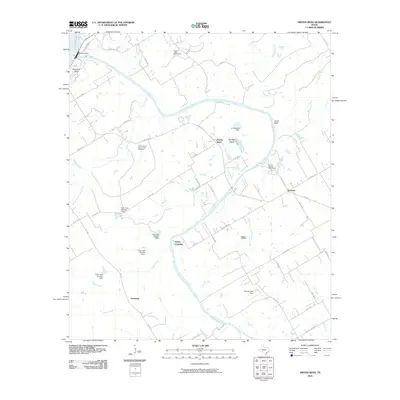
2010 Map of Smiths Bend
USGS Topo · Published 2010About this map
The Brazos River carves a deep path through this Hill County landscape, defined by dramatic river bends and significant water management infrastructure. Near the northern edge of the sheet, the Whitney Dam holds back the waters of Lake Whitney, while further downstream, smaller structures like the G J Roberts Dam and several numbered impoundments on Cedar Creek — such as K Bar Lake Number 1 Dam — regulate the local drainage.
Find a feature on this map
57 named features on this map. Tap any name to fly to it.
Don’t see what you’re looking for? This feature index may not catch every label — zoom into the map to look around manually.
Map Details
Editions of this 2010 Smiths Bend Map
This is the sole edition of this map. No revisions or reprints were ever made.
Other maps of this area

1892 · Waco
USGS Topo · 1:125,000

1920 · Waco
USGS Topo · 1:125,000

1924 · Waco 2-b
USGS Topo · 1:48,000

1931 · Whitney
USGS Topo · 1:62,500

1931 · Valley Mills
USGS Topo · 1:62,500

1931 · Elm Mott
USGS Topo · 1:62,500

1954 · Waco
USGS Topo · 1:250,000

1955 · Waco
USGS Topo · 1:250,000

1957 · Aquilla
USGS Topo · 1:24,000
1957 · Peoria
USGS Topo · 1:24,000