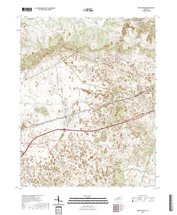
2022 Map of Smiths Grove
USGS Topo · Published 2022About this map
Smiths Grove serves as the central hub of this modern topographic survey, located at the intersection of Louisville Rd and State Hwy 101. The landscape is defined by the unique karst topography typical of the region, featuring numerous knobs and sinkholes that influence the placement of historic cemeteries and farmsteads. To the south, Pilot Knob and Smiths Grove Knob stand as prominent landmarks, while the northern edge of the map reaches into the boundary of Mammoth Cave National Park.
Find a feature on this map
120 named features on this map. Tap any name to fly to it.
Don’t see what you’re looking for? This feature index may not catch every label — zoom into the map to look around manually.
Map Details
Editions of this 2022 Smiths Grove Map
This is the sole edition of this map. No revisions or reprints were ever made.
Other maps of this area

1921 · Bowling Green
USGS Topo · 1:62,500

1922 · Brownsville
USGS Topo · 1:62,500

1922 · Mammoth Cave
USGS Topo · 1:62,500

1923 · Bowling Green
USGS Topo · 1:62,500

1923 · Mammoth Cave
USGS Topo · 1:62,500

1923 · Brownsville
USGS Topo · 1:62,500

1926 · Scottsville
USGS Topo · 1:62,500

1954 · Evansville
USGS Topo · 1:250,000

1954 · Bristow
USGS Topo · 1:24,000
1954 · Brownsville
USGS Topo · 1:24,000