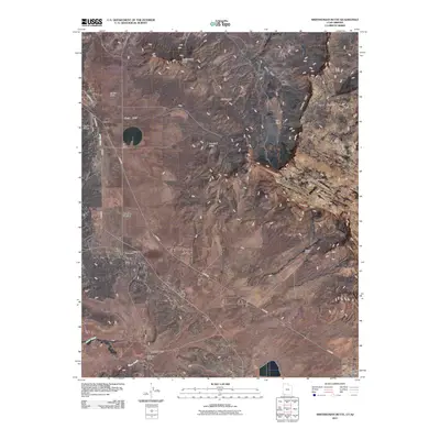
2011 Map of Smithsonian Butte
USGS Topo · Published 2011About this map
Smithsonian Butte stands as a prominent landmark in this borderland between Utah and Arizona, overlooking a landscape defined by dramatic elevation changes and sparse settlement. The high plateaus of Canaan Mountain and the striking Vermilion Cliffs dominate the eastern half of the map, creating a natural barrier that channelizes movement toward the Big Plain. This wide basin facilitates a junction of routes at Big Plain Junction, where E Hwy-59 serves as the primary artery connecting the rural outskirts of Apple Valley to the surrounding canyon country.
Find a feature on this map
21 named features on this map. Tap any name to fly to it.
Don’t see what you’re looking for? This feature index may not catch every label — zoom into the map to look around manually.
Map Details
Editions of this 2011 Smithsonian Butte Map
This is the sole edition of this map. No revisions or reprints were ever made.
Other maps of this area

1885 · St. George
USGS Topo · 1:250,000

1886 · Kanab
USGS Topo · 1:250,000

1886 · Mt. Trumbull
USGS Topo · 1:250,000

1886 · Kaibab
USGS Topo · 1:250,000

1891 · St. George
USGS Topo · 1:250,000

1892 · Mt. Trumbull
USGS Topo · 1:250,000

1953 · Cedar City
USGS Topo · 1:250,000

1953 · Grand Canyon
USGS Topo · 1:250,000

1954 · La Verkin 4 SE
USGS Topo · 1:24,000

1954 · La Verkin 4 NW
USGS Topo · 1:24,000