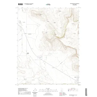
2020 Map of Smithsonian Butte
USGS Topo · Published 2020About this map
Smithsonian Butte and the towering Vermilion Cliffs anchor this geographic study along the border of Washington County and Arizona. The landscape transitions from the high elevations of Canaan Mtn and Lower Mtn down toward the Big Plain, where the community of Apple Valley is situated. This region is characterized by significant topographic relief, with drainage features like Gould Wash and Canaan Wash cutting through the terrain.
Find a feature on this map
39 named features on this map. Tap any name to fly to it.
Don’t see what you’re looking for? This feature index may not catch every label — zoom into the map to look around manually.
Map Details
Editions of this 2020 Smithsonian Butte Map
This is the sole edition of this map. No revisions or reprints were ever made.
Other maps of this area

1885 · St. George
USGS Topo · 1:250,000

1886 · Kanab
USGS Topo · 1:250,000

1886 · Mt. Trumbull
USGS Topo · 1:250,000

1886 · Kaibab
USGS Topo · 1:250,000

1891 · St. George
USGS Topo · 1:250,000

1892 · Mt. Trumbull
USGS Topo · 1:250,000

1953 · Cedar City
USGS Topo · 1:250,000

1953 · Grand Canyon
USGS Topo · 1:250,000

1954 · La Verkin 4 SE
USGS Topo · 1:24,000

1954 · La Verkin 4 NW
USGS Topo · 1:24,000