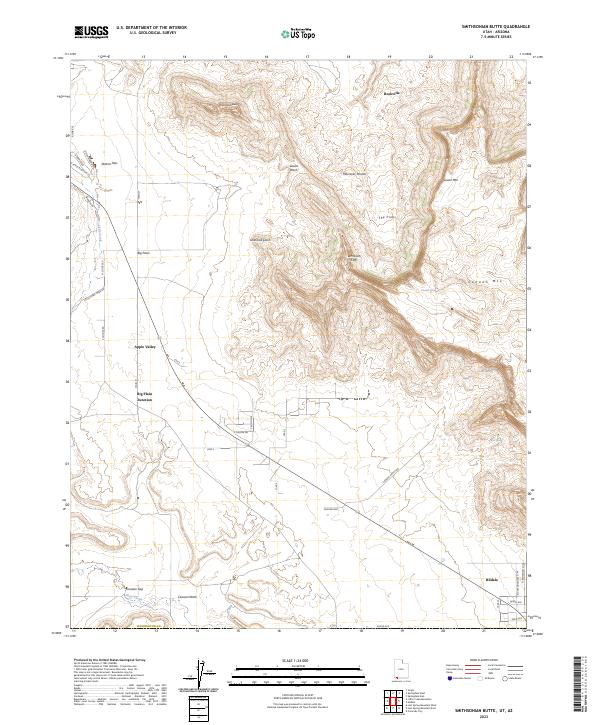
2023 Map of Smithsonian Butte
USGS Topo · Published 2023About this map
Smithsonian Butte stands as a prominent landmark in this modern-era documentation of the southwest Utah landscape. The topography is defined by the massive formations of the Canaan Mountain Wilderness and the striking Vermilion Cliffs, where drainage systems like Gould Wash and Canaan Wash have carved through the sandstone. Human settlement is concentrated in small communities such as Rockville along the northern edge and Apple Valley to the west, connected by routes like Canyon Dr and Canaan Way. To the south, the grid of Hildale appears near the Arizona border, with residential streets such as N Redwood St W and Field Ave marking the town's extent. This survey captures the intersection of high desert plateaus, including Moccasin Terrace and Lower Mtn, with the evolving infrastructure of Washington Co.
Find a feature on this map
40 named features on this map. Tap any name to fly to it.
Don’t see what you’re looking for? This feature index may not catch every label — zoom into the map to look around manually.
Map Details
Editions of this 2023 Smithsonian Butte Map
This is the sole edition of this map. No revisions or reprints were ever made.
Other maps of this area

1885 · St. George
USGS Topo · 1:250,000

1886 · Kanab
USGS Topo · 1:250,000

1886 · Mt. Trumbull
USGS Topo · 1:250,000

1886 · Kaibab
USGS Topo · 1:250,000

1891 · St. George
USGS Topo · 1:250,000

1892 · Mt. Trumbull
USGS Topo · 1:250,000

1953 · Cedar City
USGS Topo · 1:250,000

1953 · Grand Canyon
USGS Topo · 1:250,000

1954 · La Verkin 4 SE
USGS Topo · 1:24,000

1954 · La Verkin 4 NW
USGS Topo · 1:24,000